“Hāmākua ‘ama pali loa”
Waimanu Valley
Hāmākua Coast
Round Trip Mileage: 16 miles
Elevation Gain: 7000 feet

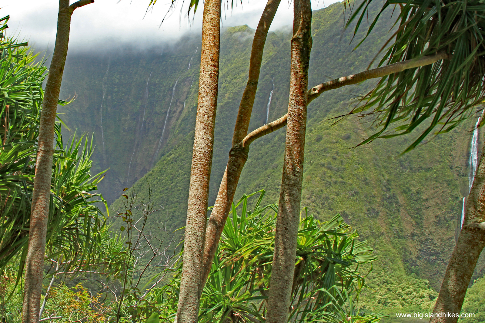
Waterfalls
As of 2/25/22, all access to Waipi’o Valley and its hiking trails is prohibited due to unsafe geologic conditions along the access road. See the County Mayor’s Order.
Waimanu is a very special place. Literally translated, wai manu means “bird water” or “river of birds.” It contains majestic waterfalls that fall more than a thousand feet from the densely vegetated valley walls. Located west of Waipi’o Valley along the windward side of Kohala mountain, this is one of the most difficult places to reach by foot on the Big Island. Indeed, many more people have viewed Waimanu Valley from a helicopter than on foot. Waimanu is probably the most popular backpacking destination on the Big Island, despite the fact that it's a very difficult trail. Find out about obtaining a camping reservation from the state DLNR.
It is possible to day hike out to Waimanu. This is an extremely difficult day hike. Take a look at the stats in the headline. Those sixteen miles are mosquito-bitten, wet, steep, rocky, and unforgiving. It's considerably more than a vertical mile of elevation gain. You’ll need to cross one river where it meets the ocean and at least 12 other streams, all of which carry high flash flood danger and can become impassable at any time, stranding you. The trail has high rockfall danger and a fall in some spots could send you up to five hundred feet.
Note that even doing a portion of this hike would be very rewarding. A challenging day is to start at Waipi’o and hike up and over the other side to view waterfalls and a part of the rainforest along the Muliwai Trail. If you choose to attempt any or all of this trail, especially if you try to go to Waimanu in a day, use these tips: start at dawn; choose a good day for high and low tide at Waipi’o river crossing; carry much more water than you think you need; set specific turn-around criteria and time; watch the weather and flash flood danger.
Trailhead: From Honoka’a in the northern part of the island, take Hwy. 240 west to Kukuihaele. The road comes to a dead end at the Waipi’o Overlook. Parking can be difficult at the small parking area, and take care to park in an appropriate place if you park up the road. This is the trailhead for two-wheel drive vehicles. There is a good overlook worth a stop near the parking area, although you can’t see much of the back of the valley. I don't recommend driving down into Waipi'o. The road is narrow, impossibly steep (25% average grade), and rough. It may be a violation of your rental car agreement. If you make it to the bottom in one piece, find an appropriate place to park and do not drive to the beach. A number of guiding services, shuttles, and horseback tours operate in Waipi’o and take also visitors down to the valley floor. Big Island Hikes does not review or endorse any commercial services.
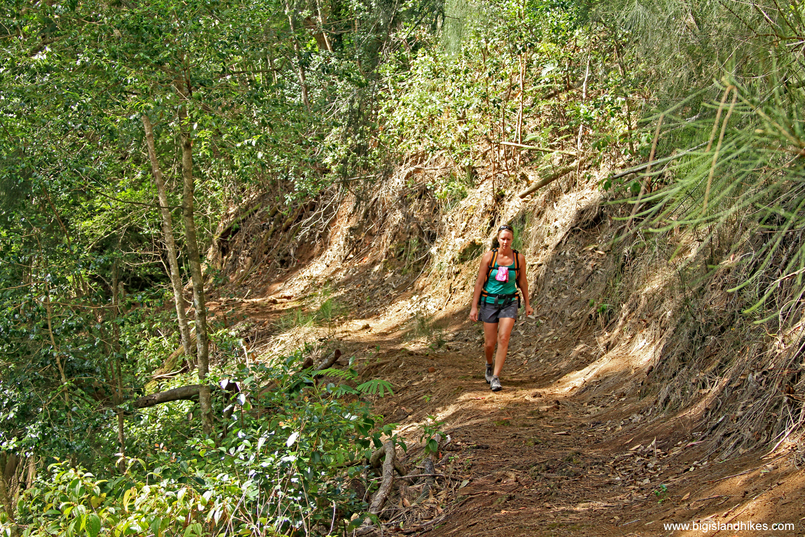
Muliwai Trail
Gear: You need to bring enough gear to keep yourself and a partner alive in the rainforest overnight. Sturdy boots are a necessity. Bring more water and food than you think you'll need.
Map
Hike: From the parking area, walk down the knee-jarring four-wheel drive road for 3/4 mile until the road levels. Follow the road toward the beach for 1/2 mile and arrive on the black sand beach. Hike west across the beach, and cross Waipi'o River where it meets the ocean. This river crossing can be treacherous and should be attempted when the tide is low. Proceed to the end of the beach and look up to spot the big Z-shaped Muliwai Trail on the cliffs above. Find the beginning of the Muliwai Trail marked by an array of state signs. Climb steeply for more than 1000 vertical feet across the switchbacks. Take care with your footing and also try to prevent knocking any loose stones onto the trail below. There are many spots with fabulous views of Waipi'o Valley and Hi'ilawe Falls. After cresting the cliff into a cool Pacific pine rainforest, you’ll now need to cross about 12 different streams where you stay mostly 800’ – 1300’ above the ocean below, which you can rarely see. The Muliwai Trail gets less and less prominent as you continue toward Waimanu Valley, as it gains and loses elevation across the streams. Most stream crossings should be easy rock-hops, but always consider flash flood danger. A slip in many of these minor stream systems can produce a nasty fall. Eventually, you’ll reach your first vantage of Waimanu Valley. Be sure to take in every break in the rainforest as you descend into the magical valley: your best views of the waterfalls are actually from up here for perspective. The trail ends near the Waimanu Valley beach, where you’ll need to cross the Waimanu River to access the campsites and the other side of the valley. It‘s possible to explore further back into the valley off-trail, but the terrain is very overgrown.
If you’re heading back in a day, tonight’s forecast is going to be extended periods of pain. Repeat what you just did.

Waimanu Valley Beach